
In partnership with AECOM Tishman, NJ Wind Port is the nation’s first purpose-built offshore wind marshaling port that is expected to support up to $500 million in new economic activity within the State of NJ and other regions each year.
As a contractor for AECOM Tishman, we have routinely surveyed 380+ acres of land parcels since February 2022 for approximately 24+ months completion timeline. Using DroneDeploy platform, we have processed 2D orthomosaics and 3D models that is utilized to make effective earth cut/fill measurements, construction monitoring and stakeholder data sharing.

Our drone platforms consisted of DJI Mavic 3 Enterprise, a 20 megapixels/mechanical shutter camera that is ideal for aerial photogrammetry projects--with its ability to eliminate rolling shutter distortion/'jello' effect; and the Mavic 2 Pro--with its high quality Hasselblad, 20 megapixel camera ideal for cardinal aerial overview pictures and 4K video recording.
To learn more, visit: https://nj.gov/windport/

NRG has acquired Dandan utility-scale solar facility from Quantum Guam Power Holdings, LLC and coordinates electricity distribution with Guam Power Authority (GPA). The solar facility is the largest in the island and comprised of over 120,000 photo voltaic (PV) panels and can power 10,000+ homes at full capacity. It has been operational since October 2015.
Raptor Maps was contracted to conduct a comprehensive aerial inspection using their proprietary Advanced Analytics, Insights & Productivity Software--that facilitates identification, classification and 100% prioritization of all anomalies with easy-to-use reports.
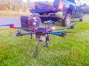
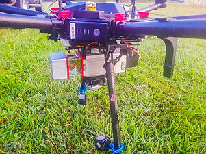
As a sub-contractor for Raptor Maps, we have traveled to Guam in March 2022 on a 5-days comprehensive inspection project using the DJI Matrice 210 and Zenmuse XT2 (640x512 thermal resolution, 19mm lens, and 12 megapixels RGB camera). To date we have inspected 240+ MW solar sites in Mainland United States.


Possible defective individual cell and substring.
To learn more, visit: http://52.15.66.9/projects/generation/dandan-in-guam/
Commercial Real-Estate Property Management
Inspections/Survey Aerial Data
ID Plans provides a comprehensive property digital data in the commercial real estate landscape using cloud-based software applications--that allows for safe sharing of assets with vendors, potential tenants, and team members across the globe.
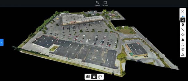

As a contractor for ID Plans, we have efficiently collected aerial mapping imagery, aerial orbit videos, aerial and ground panoramas of commercial properties throughout New Jersey, Pennsylvania and New York utilizing a wide variety DJI drones such as the Matrice 300 / 45 megapixels P1 camera, Mavic 2 Pro and Mavic 3 Enterprise. We processed these collected data using DroneDeploy.
To learn more, visit: https://www.idplans.com/
Light detection and Ranging (LiDAR) Inspection for PPL Electric Utilities

In partnership with PrecisionHawk, we have worked with PPL Electric Utilities in 2019 on a two months project to inspect single and 3-phase electric utility poles using LiDAR-equipped drone system i.e. DJI Matrice 600 and RIEGL miniVUX-3UAV to conduct right-of-way, vegetation encroachment, and safety inspections. During this period, we have surveyed approximately 500 miles of PPL's power line assets.